Steep street
Costereta del Forn
(Cuesta del Horno)
Map of Costereta del Forn. Extract from our own map, about 80 m on each side, with north at the top and a 20 m scale bar. Highlighted: Costereta del Forn (Cuesta del Horno). The houses around it link to their records; the lists on the page have the same links.
- Its houses
- Other houses
A steep street in the Poble Vell (the old village) of Mequinenza, which stood by the Ebro and was demolished from 1970 onwards to make way for the Riba-roja reservoir.
It has 11 houses in the reconstruction.
Names
| In Catalan | Costereta del Forn |
|---|---|
| In Spanish | Cuesta del Horno · translation awaiting review |
| Other names | «Costereta el Forn» |
| 1968 map | No. 14 in the key to the 1968 map |
| Identifier | costereta-forn |
Where each name comes from
We have not yet recorded which document each name comes from.
Photos recreated with AI
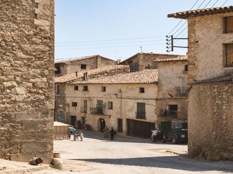
Bajada de la Costereta del Forn hacia la taberna de Canero
Recreación cromática y visual mediante IA a partir de fotografía histórica. Una cuesta de casas de piedra baja hasta un ensanche, con un quiosco, un camión parado y niños y vecinos pequeños. What the AI changed
- Los niños y vecinos pequeños del centro salen más definidos que en la foto.
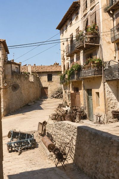
Costereta del Forn, con las herrerías
Recreación cromática y visual mediante IA a partir de fotografía histórica. Cuesta con casas de cuatro plantas y balcones corridos, aperos de labranza y una bicicleta delante de las herrerías, y una muralleta de piedra en primer plano. What the AI changed
- Añade macetas con flores rojas y verdes en los balcones de la fachada alta.
Houses 11 in the reconstruction
- Casa de la Costereta del FornShape: hypotheticalAppearance: hypothetical
- Casa de la Costereta del FornShape: hypotheticalAppearance: hypothetical
- Casa de la Costereta del FornShape: hypotheticalAppearance: hypothetical
- Casa de la Costereta del FornShape: hypotheticalAppearance: hypothetical
- Casa de la Costereta del FornShape: hypotheticalAppearance: hypothetical
- Manzana 30, n.º 22Shape: hypotheticalAppearance: hypothetical
- Casa de la Costereta del FornShape: hypotheticalAppearance: hypothetical
- Casa de la Costereta del FornShape: hypotheticalAppearance: hypothetical
- Casa de la Costereta del FornShape: hypotheticalAppearance: hypothetical
- Casa de la Costereta del FornShape: hypotheticalAppearance: hypothetical
- Casa de la Costereta del FornShape: hypotheticalAppearance: hypothetical
costereta-forn · steep street · 11 houses · 1 section on the map · no. 14 on the 1968 map