Mequinenza · Bajo Cinca
How it was made
This is how we are rebuilding the Poble Vell (the old village): where each house comes from, how it is checked, what tools we use and how mistakes are corrected. It is a work in progress, and this page grows with it.
In brief
- Everything is drawn over the photo from the 1956–57 American aerial survey, fitted to the real terrain with an error of one to four metres.
- The houses come from a single master plan, drawn by hand house by house; a program builds the whole village from it.
- The village is checked area by area against the old photos: we work out where each photo was taken from and place the model over it to see whether it fits.
- Every piece of information says how much is known about it: documented, inferred or hypothetical.
- Artificial intelligence helps with programming and calculations, but an image made with AI is never a source.
1. The sources
The Poble Vell was demolished from 1970 onwards, when the Riba-roja reservoir was going to flood its lower part. To build it again, several sources are combined, each one used for what it does best:
- The 1956–57 American aerial survey (orthophoto from the Instituto Geográfico Nacional). It is the plan of the village seen from the sky: blocks, streets, courtyards and trees. The shadows help too: during that flight, on 19 April 1957, the sun was 55.6° above the horizon, and the length of each shadow gives the height of the house that casts it.
- The ‘Nucli urbà de la vila de Mequinensa’ map (1968). It gives the street names. It is less accurately drawn (errors of 6 to 10 m), so it is not used to place houses.
- The real terrain (LiDAR from the IGN): the mountains, the castle and the ruins that remain. On top of it the 1965 terrain is rebuilt, with the river at its level at the time, and its ground is painted with what the 1956–57 survey shows: scrub, fields, tracks and beaches, with interpretive colouring.
- More than 3,000 old photographs from the Town Council’s collection, from the ‘Recuerdos de papel’ books and from families, catalogued and placed on the map. They are the basis for working out each house, but they are not published on this website. Those cited in the records are listed in Sources, by their identifier.
- The project author’s readings of the photos: houses, shops and corners identified in them (the Casino, the Ebro bar, the chemist’s, the kiosks in the square…), always with the photo that supports each one.
2. One map for everything
Everything sits in the same coordinate system, in metres: eastwards, northwards and height above sea level. It is tied to what still stands and can be measured today: the castle, the ruins of the church, the bridge abutments and the outline of the mountains.
The aerial photo and the 1968 map are fitted using control points. The aerial photo is accurate to one or two metres in the centre of the village and to about four at the western end; the 1968 map, much less accurate, is only used for the names. That way, a house drawn on the photo, an old photo of that street and the terrain all point to the same spot.
3. The plan of the houses and the whole village
The project’s author drew by hand, over the aerial photo, every block in the village, the party walls between the houses and the courtyards. That drawing is the centre of everything: it goes into a master plan together with the streets, the squares and the landmark buildings (the church, Ca la Vila, Lo Muro).
- Master plan. Each house with its fixed number (MQN-BLD-…), its footprint, its storeys, its roof and where each piece of information comes from.
- Surfaces. Streets, squares and steps, right up to the façades that look onto them.
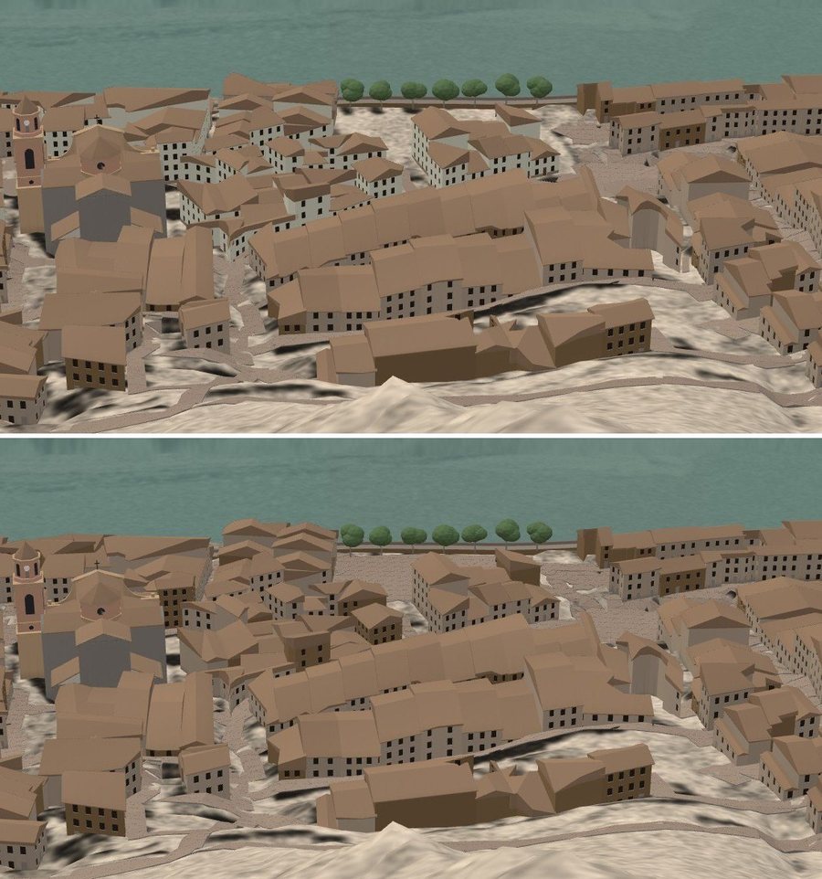
- Generation. A single program in Blender builds the whole village (currently 541 houses) with façades, doors and windows, eaves and roofs, set on the 1965 terrain.
- Website. The model is made lighter and published in the 3D viewer, and each house has its record on these pages.
If the plan changes, everything is rebuilt with a single command. Nothing is touched up by hand in the 3D model: that way, when a new piece of information turns up, the whole village takes it in without losing what was already right. The drawing of the master plan can be seen in Explore.
4. House by house, area by area
The first model is an approximation. Then it is gone over in small areas (Plaça d'Armes, the little square by the church…), and in each one:
Gathering and identifying the photos
All the photos of the area are tracked down and, with the author, each one is matched to its house: ‘this is the chemist’s’, ‘the Casino is on the other side of the ramp’.
Working out where each photo was taken from
Using points that are known both in the photo and on the map (the corners of the church, the castle, the outline of the mountain), we work out where the photographer stood, which way they were looking and what lens they used. With that camera, the model is drawn over the photo: if a façade comes out too wide, the eaves too low or a roof the wrong way round, it shows straight away and is corrected. When a single photo is misleading, several are fitted at once.
Measuring heights from the shadows
Where the shadow of a house falls on open ground in the aerial photo, its length gives the eaves height. With the sun on that day (55.6° high and from the south-east), every metre of shadow means about 1.5 m of height.
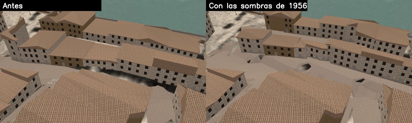
Anything that does not appear in any photo stays as it was in the master plan, marked as hypothetical, until new photos turn up. An area is closed with the photos available and reopened when more arrive.
5. What is known and what is not
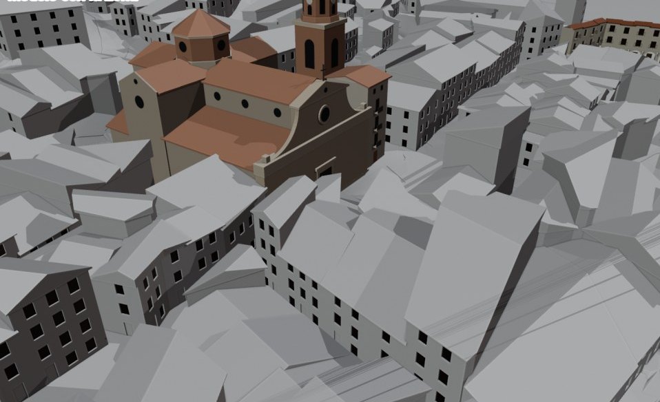
Every piece of information about each house (its footprint, its height, its roof) carries a level of evidence and the sources it comes from:
- Documented A photo or a document says so directly.
- Inferred Deduced with a method that can be checked: shadows, calculated cameras, comparison between photos.
- Hypothetical Information is missing: it is a provisional shape, reasonable for the period.
In the 3D viewer, the ‘Evidence’ mode (in the new viewer it will be called ‘What we know’) colours each house by its level, and clicking a house opens its record, with what is known and where it comes from. House numbers never change and are never reused, so that any reference stays valid. We explain it with examples in What we know.
6. When something goes wrong: Lo Muro
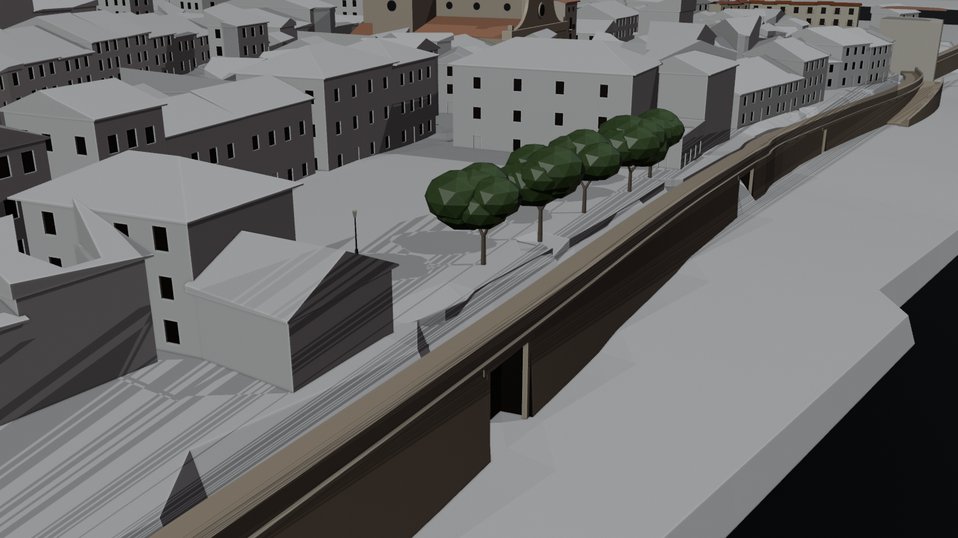
An example of how the work is done. Lo Muro is the great river wall above the Ebro, with the promenade and the road on top. When work on Plaça d'Armes was finished, the Casino appeared on top of the wall and the square came out too narrow.
The cause went back further: the line of the wall had been fitted to a dark band that runs along the foot of the first row of houses, read as the shadow of the parapet. But the sun during that flight came from the south-east, so shadows fall to the north of things, never to the south. That band could not be the shadow of the parapet. The photo was reliable; the reading was not.
There was an independent check. Two old photos of the square were taken ‘by the parapet’. When their cameras were calculated, without using any information about the wall, the photographer ended up 6 m outside the previous wall, in mid-air above the beach, and just inside the strip drawn by the author.
The fix:
- The wall now follows that strip from the Molí d'Oli to the square.
- The square gets back its width, with its five trees beside the road.
- The Casino and the Ebro bar now sit on the promenade.
- The opening in the wall is where the ramp down to the river came out.
And the programs now have a rule: no house and no cobbled paving may sit on the wall. If a house is ever drawn on top of it, the plan is not applied.
7. Artificial intelligence, used with care
Much of the technical work is done with the help of artificial intelligence assistants (Claude and ChatGPT, among others): writing the programs, fitting photos, doing calculations, generating the model and looking for information. Everything is checked against the photos and with the author, and is written down in a work diary and a decision log.
The golden rule: an image made or retouched with AI is never a source. A photo coloured, enlarged or ‘enhanced’ with AI can invent details (the letters on a sign, windows, roof tiles), so it is never used to measure anything or to decide the shape of a house. If one is ever shown, it is labelled as such.
The textures of the materials (stone, roof tiles, plaster, cobbles), on the other hand, are AI-generated, from photos of the period: they are a visual finish, not evidence of anything. And the old photos are not uploaded to outside services without permission.
8. Tools
- Blender: the village generator and the landmark buildings.
- Python (NumPy, Shapely, OpenCV): fitting photos and maps, cameras, shadows and checks.
- Three.js: the website’s 3D viewer.
- glTF Transform: lightweight models for the web.
- Unreal Engine: a desktop viewer for walking around the village, still being tested.
- CorelDRAW: the hand-drawn plan of the houses.
- TypeScript and Vite: these pages, generated from the project’s database.
- Cloudflare Pages: hosting for the website.
- Public data from the IGN (orthophotos, LiDAR and terrain), under a CC BY 4.0 licence.
9. What already existed
The Poble Vell already had people who remembered it and showed it to others. This reconstruction builds on that work and adds to it:
- ‘La memòria dels carrers’ (Centro de Estudios Jesús Moncada, since 2018): meetings of former residents, street by street, that collect memories, documents and photos. One of its sessions, on the Museos de Mequinenza website (another website)
- ‘Imágenes para la memoria’ (Museos de Mequinenza, 2020): nearly 300 photographs of the old village, each one placed where it was taken. It grew out of ‘La memòria dels carrers’. Imágenes para la memoria (another website)
- The municipal Poble Vell route (Mequinenza Town Council, since 2013): 10 stops around what remains of the village, with audio guides in four languages. It used to have augmented reality, with 3D objects over six printed markers that could be seen with an Android app, now withdrawn. The route and its audio guides, on the Town Council’s website (another website)
10. How to follow the work
Progress updates are published, with their dates, in Progress. This is an open project: if you have photos of the Poble Vell, especially of lesser-known houses and streets, or memories of what they were like, they are a great help. How to send them is explained in Contribute.