Record · MQN-BLD-0446
Casa de Lo Muro
Plot plan (c. 1965) manzana 7, casa 8 Inferred source
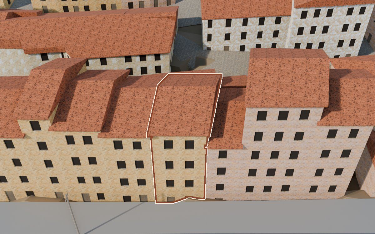
One of the 541 houses in the reconstruction of the Poble Vell (the old village) of Mequinenza, demolished from 1970 onwards to make way for the Riba-roja reservoir. It appears in one archive photograph.
- Shape
- Inferred
- Appearance
- Hypothetical
How we know
Every piece of information in the model, with its level, its sources, its uncertainty and how it was obtained. The photographs are cited; they will be shown when there is permission to publish them.
Documented Inferred Hypothetical
| Feature | In the model | Level | Sources | Uncertainty | Method |
|---|---|---|---|---|---|
| Shape | |||||
| Footprint | 63 m² | Inferred | 2 sources · Plano de casas del proyecto, dibujado sobre la foto aérea del vuelo americano (19-04-1957), Ortofoto del vuelo americano, serie B | ± 1 m along the outline | La manzana 52 del plano de casas entre el borde de la carretera y la fila de atrás (sector oeste), partida por las fachadas de MUNI_rio_562 |
| Storeys | 4 storeys | Inferred | 1 source · MUNI_rio_562 | Not calculated | Calculadas con la altura del alero, a 3,15 m por planta |
| Eaves height | 13,9 m | Inferred | 1 source · MUNI_rio_562 | ± 1 m | Alero sobre la albardilla en MUNI_rio_562 de frente desde el río, con la escala de las bocas 3 y 4 (11,15 px/m) y un 6 % más por estar la fachada unos 7 m detrás de la cara; más 1 m de la albardilla a la carretera; más 3,3 m, lo que su base queda bajo la carretera (: el tejado no se mueve) |
| Roof | dos aguas | Inferred | 2 sources · MUNI_rio_562, Ortofoto del vuelo americano, serie B | Not calculated | A dos aguas con la cumbrera paralela a la carretera, como las de MUNI_rio_562 |
| AppearanceColourising is not evidence: the colour of the model is an interpretation. | |||||
| Façade | Revoco ocre | Hypothetical | No source | Not calculated | Acabado de la regla general del modelo, según el tipo de casa; sin fuente propia |
Sources 3 in total
2 documents and 1 archive photograph. The photographs are cited by their identifier and collection; they will be shown when there is permission to publish them.
- Plano de casas del proyecto, dibujado sobre la foto aérea del vuelo americano (19-04-1957)Archivo del proyecto (MQN-SRC-PLANO-PROPIETARIO) · 2026, sobre la foto aérea de 1957
- Ortofoto del vuelo americano, serie BIGN, WMS https://www.ign.es/wms/pnoa-historico, capa AMS_1956-1957 · 1956-1957
- Colección municipal de Mequinenza · 1 photographcarpeta «Rio»: MUNI_rio_562
Neighbouring houses
Map of the surroundings: Casa de Lo Muro. Extract from our own map, about 80 by 50 m, with north at the top and a 20 m scale bar. Highlighted: Casa de Lo Muro. The houses around it link to their records; the lists on the page have the same links.
- Casa de Lo MuroShape: inferredAppearance: hypothetical
- Casa de Lo MuroShape: inferredAppearance: hypothetical
- Casa del Carrer de la BarcaShape: hypotheticalAppearance: hypothetical
- Casa de Lo MuroShape: inferredAppearance: hypothetical
- Casa de Lo MuroShape: inferredAppearance: hypothetical
- Casa del Carrer de la BarcaShape: hypotheticalAppearance: hypothetical
MQN-BLD-0446 · Lo Muro · plot plan: manzana 7, casa 8 · shape: inferred · appearance: hypothetical · 3 sources · sin revisar