Alley
Carreró de la Palma
(Calle La Palma)
Not yet drawn on the map
We know its name, but we have not yet drawn where it ran on the project’s map.
An alley in the Poble Vell (the old village) of Mequinenza, which stood by the Ebro and was demolished from 1970 onwards to make way for the Riba-roja reservoir.
No houses have been assigned to it in the reconstruction yet.
Names
| In Catalan | Carreró de la Palma |
|---|---|
| In Spanish | Calle La Palma · as in the photo captions |
| Other names | «Calle La Palma» · «Carrer de la Palma» |
| 1968 map | No. 22 in the key to the 1968 map |
| Identifier | carrero-palma |
Where each name comes from
- «Callejón de la Palma» · official name, from hacia 1965Plano parcelario municipal (MQN-SRC-PLANO-PARCELARIO): rótulos R011 (hoja_centro): «Callejón de la Palma»; R091 (hoja_este): «C. la Palma»; transcripción en trabajo/plano_parcelario/rotulos.json
Photos recreated with AI
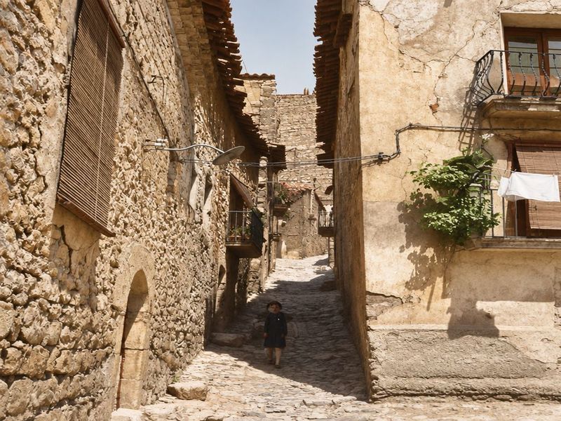
Carreró de la Palma
Recreación cromática y visual mediante IA a partir de fotografía histórica. Callejón empedrado entre muros de mampostería, con un portal de arco, un balcón con plantas, ropa tendida, una farola de brazo y una figura al fondo. What the AI changed
- La figura del fondo gana ropa y sombrero definidos que la foto apenas deja ver.
- La pared de la izquierda sale con piedras mucho más abultadas que en la foto.
carrero-palma · alley · 0 houses · not yet drawn on the map · no. 22 on the 1968 map