Record · MQN-BLD-0408
Casa del Carrer Major
Plot plan (c. 1965) manzana 14, casa 4 Inferred source
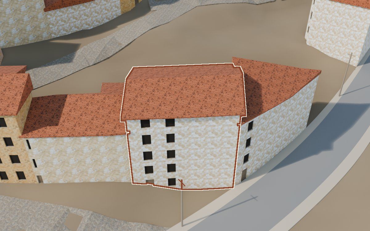
One of the 541 houses in the reconstruction of the Poble Vell (the old village) of Mequinenza, demolished from 1970 onwards to make way for the Riba-roja reservoir. No archive photograph has been cited as a source for it yet.
- Shape
- Hypothetical
- Appearance
- Hypothetical
How we know
Every piece of information in the model, with its level, its sources, its uncertainty and how it was obtained. The photographs are cited; they will be shown when there is permission to publish them.
Documented Inferred Hypothetical
| Feature | In the model | Level | Sources | Uncertainty | Method |
|---|---|---|---|---|---|
| Shape | |||||
| Footprint | 121 m² | Inferred | 2 sources · Ortofoto del vuelo americano, serie B, Nucli urbà de la vila de Mequinensa (1968) | ± 2.5 m along the outline | Contorno y medianeras que se ven, dibujados a mano sobre la ortofoto del vuelo de 1956-57 |
| Storeys | 5 storeys | Hypothetical | No source | ± 1 storey | Por la regla general del modelo: entre 2 y 4 plantas según el tipo de casa; sin medida propia de esta casa |
| Eaves height | 12,4 m | Inferred | 1 source · Ortofoto del vuelo americano, serie B | ± 0.8 m | Sombra del vuelo del 19-04-1957 (sol 55,6°, azimut 147°), 70 perfiles; alero 7,13 m sobre el suelo al pie de la fachada norte (la mitad central de los perfiles, entre 6,92 y 7,43 m). La ficha da 12,4 m porque cuenta la altura desde el punto más bajo de la casa, que en ladera queda por debajo del pie de la fachada norte |
| Roof | dos aguas | Hypothetical | No source of its own · reference: MUNI_lopoble_362, T1B_p103_1 | ± 1.5 m | Tejado inclinado de la regla general del modelo, con la forma simplificada |
| AppearanceColourising is not evidence: the colour of the model is an interpretation. | |||||
| Façade | Cal | Hypothetical | No source | Not calculated | Acabado de la regla general del modelo, según el tipo de casa; sin fuente propia |
Sources 2 in total
2 documents.
- Ortofoto del vuelo americano, serie BIGN, WMS https://www.ign.es/wms/pnoa-historico, capa AMS_1956-1957 · 1956-1957
- Nucli urbà de la vila de Mequinensa (1968)Copia digital; procedencia original por establecer · 1968
References for the hypotheses
- Colección municipal de Mequinenza · 1 photographcarpeta «Lo poble»: MUNI_lopoble_362
- «Recuerdos de papel» · 1 photographtomo 1B, p. 103, foto 1: T1B_p103_1
Neighbouring houses
Map of the surroundings: Casa del Carrer Major. Extract from our own map, about 104 by 65 m, with north at the top and a 20 m scale bar. Highlighted: Casa del Carrer Major. The houses around it link to their records; the lists on the page have the same links.
- Casa del Carrer del RosariShape: hypotheticalAppearance: hypothetical
- Casa del Carrer MajorShape: hypotheticalAppearance: hypothetical
- Casa del Carrer MajorShape: hypotheticalAppearance: hypothetical
- Casa del Carrer del RosariShape: hypotheticalAppearance: hypothetical
- Casa del Carrer de la PuríssimaShape: hypotheticalAppearance: hypothetical
- Casa del Carrer BarrinolShape: hypotheticalAppearance: hypothetical
MQN-BLD-0408 · Carrer Major · plot plan: manzana 14, casa 4 · shape: hypothetical · appearance: hypothetical · 2 sources · sin revisar