Record · MQN-BLD-0019
Edificio bajo con terraza
Plot plan (c. 1965) manzana 10, casa 7 Inferred reading still to be checked source
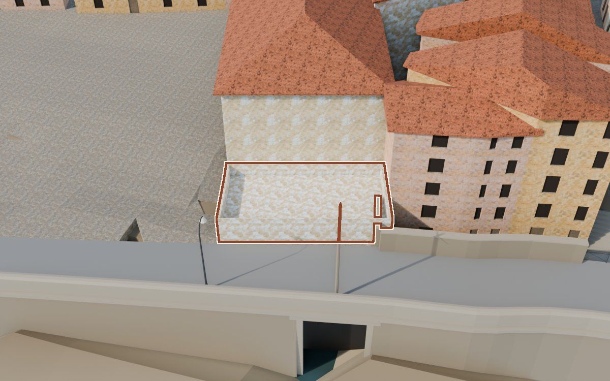
One of the 541 houses in the reconstruction of the Poble Vell (the old village) of Mequinenza, demolished from 1970 onwards to make way for the Riba-roja reservoir. It appears in 2 archive photographs.
- Shape
- Inferred
- Appearance
- Hypothetical
How we know
Every piece of information in the model, with its level, its sources, its uncertainty and how it was obtained. The photographs are cited; they will be shown when there is permission to publish them.
Documented Inferred Hypothetical
| Feature | In the model | Level | Sources | Uncertainty | Method |
|---|---|---|---|---|---|
| Shape | |||||
| Footprint | 75 m² | Inferred | 3 sources · Plano de casas del proyecto, dibujado sobre la foto aérea del vuelo americano (19-04-1957), Ortofoto del vuelo americano, serie B, MUNI_plaza_512 | ± 1.5 m along the outline | De 23,2 a 29,45 m del frente, medido en MUNI_plaza_512; el fondo no se ve en ninguna foto y se toma el del caserón, 12 m (hipotético) |
| Storeys | 1 storey | Inferred | 2 sources · MUNI_plaza_512, MUNI_plaza_505 | ± 0.3 storeys | Una planta |
| Eaves height | 3,6 m | Inferred | 1 source · MUNI_plaza_512 | ± 0.5 m | Proporción con la fachada del caserón en MUNI_plaza_512: 64 px hasta el suelo de la terraza frente a 194,5 px del caserón (11,1 m), 3,6 m; encima, la celosía de unos 0,9 m |
| Roof | Plana (terraza) | Inferred | 2 sources · MUNI_plaza_512, MUNI_plaza_505 | ± 0.3 m | Terraza plana con barandilla de celosía |
| AppearanceColourising is not evidence: the colour of the model is an interpretation. | |||||
| Façade | Cal | Hypothetical | No source | Not calculated | Acabado de la regla general del modelo, según el tipo de casa; sin fuente propia |
Sources 4 in total
2 documents and 2 archive photographs. The photographs are cited by their identifier and collection; they will be shown when there is permission to publish them.
- Plano de casas del proyecto, dibujado sobre la foto aérea del vuelo americano (19-04-1957)Archivo del proyecto (MQN-SRC-PLANO-PROPIETARIO) · 2026, sobre la foto aérea de 1957
- Ortofoto del vuelo americano, serie BIGN, WMS https://www.ign.es/wms/pnoa-historico, capa AMS_1956-1957 · 1956-1957
- Colección municipal de Mequinenza · 2 photographscarpeta «Plaza de Armas»: MUNI_plaza_512, MUNI_plaza_505
Neighbouring houses
Map of the surroundings: Edificio bajo con terraza. Extract from our own map, about 80 by 50 m, with north at the top and a 20 m scale bar. Highlighted: Edificio bajo con terraza. The houses around it link to their records; the lists on the page have the same links.
- Casa de Lo MuroShape: hypotheticalAppearance: hypothetical
- Caserón del portal de arcoShape: inferredAppearance: hypothetical
- Casa de Lo MuroShape: hypotheticalAppearance: hypothetical
- Casa del Carrer del ViudoShape: hypotheticalAppearance: hypothetical
- Casa del Carrer del ViudoShape: hypotheticalAppearance: hypothetical
- Casa del Carrer del ViudoShape: hypotheticalAppearance: hypothetical
MQN-BLD-0019 · Plaça d'Armes · plot plan: manzana 10, casa 7 · shape: inferred · appearance: hypothetical · 4 sources · sin revisar